
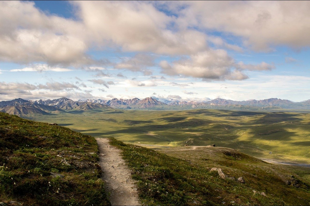
Alaska gives you paved glacier-view loops, river valleys, and ridgelines you can only reach by boat. That range is the appeal. It’s also the problem, because a trail rating covers walking difficulty and nothing else. A 3.2-mile route rated easy can still require a water taxi, a scheduled pickup, and a plan for the afternoon if the weather turns.
Pick the route first, then build the day around it. Hiking in Alaska rewards that order.
Why Does Hiking in Alaska Work Differently?
The National Park Service warns that most hiking in Alaska takes place off maintained trails and that experienced hikers still struggle with the terrain, the navigation, and the isolation. Cell service is patchy or gone. Many trailheads sit past the end of the road system, so you reach them by shuttle, boat, or plane.
Glacial streams change course and depth throughout the day. Snow lingers at higher elevations well into summer. Alder, bog, and tundra slow you in ways distance alone won’t reflect, and the weather can turn inside an hour in June, July, or August.
Because of all that, the NPS recommends planning for more time than the same mileage takes in the Lower 48, and packing for an extra day in case a boat or plane is delayed. Some routes also cross private Alaska Native corporation land on public easements, which limits where you can legally walk. That applies even to day hikes for every skill level that look simple on a map.
Which Skill Level Are You Hiking At?
When hiking in Alaska, choose a route based on the conditions and your experience, not just the trail’s rating.
Beginner
Beginner routes stay on maintained, marked trail. They’re short and gently graded, the trailheads are road-accessible, facilities sit nearby, and nothing requires river, snowfield, or glacier travel.
Beginner still isn’t risk-free. You can meet wildlife, rain, cold, and wet rock on any of them.
Intermediate
Intermediate routes ask for several hours of walking over roots, rock, and mud, plus sustained climbing and basic navigation. You carry emergency supplies, and you turn back when conditions deteriorate.
Advanced
Advanced trips involve full-day or multi-day travel, scrambling in exposed alpine terrain, unmarked sections, marine or air access, river crossings, and snowfields.
Specialist
Glaciers, off-trail wilderness, and winter mountain routes require a distinct skill set, not a tougher version of the same one. The NPS classifies the snow-covered Harding Icefield Trail as a winter mountaineering route because of the steep slopes, the route-finding, and the avalanche hazard.
Access also changes difficulty. Several excursions around Kachemak Bay combine simple walking with a boat schedule, which raises the planning load without adding physical strain.
Which Alaska Hiking Trails Match Each Level?
Easy and Accessible
The easiest Alaska hiking trails pair a short distance with road access. The Glacier View Loop at Kenai Fjords is a 1-to-1.2 mile accessible path from the Exit Glacier Nature Center. Mountain Vista at Denali is a 0.6-mile round-trip with a 5% maximum grade, takes about 30 minutes, and is accessible by vehicle or the free Savage River Shuttle.
Nugget Falls Trail near Juneau is a 0.8-mile walk along Mendenhall Lake, and Thunderbird Falls in Chugach is a 1-mile round trip with roughly 100 feet of elevation gain.
Easy Walking, Moderate Logistics
Most hiking near Homer, Alaska, starts with a boat rather than a trailhead. The Glacier Lake Trail in Kachemak Bay State Park shows the gap this guide keeps pointing at. It’s rated easy and family-suitable: 3.2 miles one way, 200 feet of gain, roughly 1.5 hours to Grewingk Glacier Lake. Hikers often add the moderate one-mile Saddle Trail and arrange a water taxi drop at Glacier Spit with a pickup somewhere else.
The walking really is beginner-friendly. The trip isn’t. There’s no road access, so you book the boat from Homer, agree on pickup points and times, and plan around the afternoon wind. Don’t enter glacier caves, climb onto the ice, or try to ford Grewingk Creek.
Stepping Up
Horseshoe Lake at Denali is a two-mile round trip that drops 250 feet over rocks and roots, with grades hitting 20 percent. Root Glacier at Wrangell–St. Elias runs four miles round-trip from Kennecott across fairly level ground.
Stepping onto the ice changes the activity entirely, and NPS recommends crampons and a guide for that. Ratings are a starting point. Bird Ridge in Chugach is rated moderate and gains 2,500 feet in 1.5 miles.
Hard Day Hikes
The Harding Icefield trail is eight miles round-trip. Expect roughly 1,000 feet of gain per mile and six to eight hours on your feet. The upper section often stays snowy into July and sits exposed to high winds and sudden temperature swings. Mount Healy Overlook at Denali is 2.7 miles one way with grades near 25 percent. Grace Ridge near Homer runs 8.9 miles one way for 3,100 feet of gain, with marine access and unmarked alpine sections.
The NPS reminds hikers they don’t need to reach the Harding summit for the day to count. Read trip reports from people who’ve done the route before you commit.
When Should You Go, And What Do You Carry?
There’s no single statewide season for hiking in Alaska, so there isn’t one best month either. The summer window in Denali runs late May through early September. Snow can fall in the mountains any month, high routes often stay snow-covered into July, and autumn arrives early at elevation.
Roads and facilities frequently close before trail conditions deteriorate. The best time to hike in Alaska is whenever conditions line up on your specific route. Denali summer temperatures average roughly 33°F to 75°F, and rangers advise preparing for sun, wind, rain, and cloud in a single day.
Pack quick-drying layers, a waterproof hooded shell, a warm hat and gloves, and broken-in boots. Bring a map, a compass, water treatment, food plus an emergency reserve, a first-aid kit, a head net, dry bags, and a headlamp. Keep bear spray within reach, and carry a satellite communicator for remote travel. Skip cotton; it dries slowly.
What Can Hurt You Out Here?
Most of what goes wrong while hiking in Alaska is predictable. Bear spray buried in a pack is the same as no bear spray.
ADF&G recommends traveling in a group, making noise near brush and blind corners, giving wildlife plenty of room, securing food, and practicing with your canister before you head into the backcountry. Moose appear alongside roads, towns, and forest paths, so give them space and never get between a mother and her calf. Check park rules before you bring a dog.
Because clear water can still carry Giardia, filter, boil, or chemically treat it, and let silty glacial water settle first. Glacial rivers are cold and opaque, and their shifting channels deepen as melting accelerates.
When a crossing looks unsafe, turn back. Reaching a glacier also isn’t the same as traveling on one, since crevasses and unstable margins call for training and equipment. Some coastal routes become inaccessible when tides rise, including part of Caines Head near Seward.
Verify permits, fees, food-storage rules, and boat schedules before you go, and remember that a 17(b) easement provides only a right of way across private property.
Tell Us Where You’re Headed
We’re in Homer, so most of this is out our back door, and the details that help people plan come from folks who were on that ridge last week. Post what you found, including the bad bits. Look at what people did last September before you commit to a date. And if you need a second person for a Grace Ridge pickup, get in touch with Launch Point and ask.